Invasive plants do not recognize human-created boundaries. Not only are they an issue in our backyards, they are also an issue at a landscape scale (neighborhood, community, state, and region). Important first steps in invasive plant management are understanding where and what species are present, the extent of the invasion in the landscape, and which populations might be a priority to treat (e.g., newly introduced; near something of value- town forest, cultural site, rare species; highly invasive- spreads quickly, hard to control).
The first two parts of this series introduced you to the idea of a management plan, and provided pointers on setting priorities. Now it’s time to fill in that management plan with data! Let’s assess the invasive plant populations.
Assessment and Maps
Knowing the scale of an infestation, and where it is located, can help landowners set priorities. This is an especially important step when resources are limited.
The Vermont Department of Forests, Parks and Recreation has started a citizen science project that allows a landowner to map invasive plants without needing expensive mapping software. The Mapping for Healthy Forests Vermont project data are housed within the larger iNaturalist.org website and the data are free to download to create specialized maps.
This work is being done to provide a baseline of data for towns, communities, and landowners. The information will be invaluable for identifying opportunities for prevention, education, project prioritization and efficient use of volunteer energy and public and private resources.
Get started today
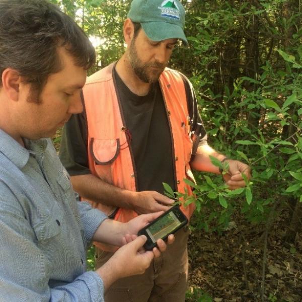
Mobile device
◦Download app “inaturalist”
◦Create account
◦Join project “Mapping for Healthy Forests: Vermont”
Camera and GPS
◦Go to www.inaturalist.org on your computer
◦Create account
◦Click “Join” for project “Mapping for Healthy Forests: Vermont”
Participate in the field
•Whenever you’re outside, walking the dog, birding, etc., be on the lookout for invasive plants
•Record their locations with your phone or GPS
•Document your observation with photographs
•Upload to the website from your phone or from your home computer
Helpful Hint *turn off auto-sync in the app on your phone, and only upload observations on wifi*
Participate Online
•Learn your plant ID at www.vtinvasives.org
•Take advantage of the expertise of members of iNaturalist if you are unsure of what you’ve observed
•Help others with their observations if you are good with ID!
Learn more
If you want to learn more about identifying invasive plants, check out the gallery of invaders on the VTInvasives.org website. Click on an individual species for more information. Each invader page includes a description and a “fact sheet” with identification tips!
Decision support tool, from The Nature Conservancy and iMapInvasives: https://www.ipmdat.org/
(Almost) gadget-free option
If you’re looking for a simpler method for tracking invasive plants on your property for your management plan, consider checking out Google Earth. You can print a map of your land, and write directly on the printed map where you are finding invasive plants, what they are, and how big the population is. This can often be a good first step in getting comfortable doing field assessments. The key with assessment and mapping is knowing what is where, so you can effectively and efficiently treat and monitor a given site.
See part 1- “Developing an Invasive Plant Management Plan” for details on how to start your own plan.
See part 2- “Outlining Purpose, Priorities, and Resources” for details on filling out your own plan.
Article Credit: Elizabeth Spinney, VT FPR
Photo Credit: Elizabeth Spinney, VT FPR, “Citizen scientist learning to use iNaturalist on a smart device.”