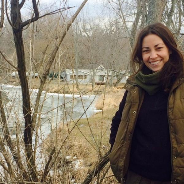
Walking through the woods in Chittenden County, you may run across someone studying a plant and photographing it with her cell phone. The Mapping for Healthy Forests pilot project has found success in the hands of a superstar volunteer, Meg McEnroe.
From New Jersey, now making her home in the Green Mountains, Meg was drawn to this project after seeing the type of damage invasive plant species can do. She says “I found it important to be part of an effort to help with the control and/or eradication of non-native invasives. I also love to be outside!”
She brings her experience from her studies in wildlife and conservation biology, and her passion for the environment and for learning new things. While she’s working to find work in conservation and management, she takes time to go out into Vermont parks and woods, mapping and documenting invasive plants.
If you enjoy spending time outside, are comfortable with a mobile device, motivated to take action, and would like to be a Mapping for Healthy Forests Superstar like Meg, contact the Invasive Plant Program for details at ANR.FPRInvasivePlants@vermont.gov
*****
The Mapping for Healthy Forests project aims to map and monitor the locations of invasive plants in Vermont, along common points of introduction, like roadways and in shared spaces like parks and town forests. With this mapping effort spread across the whole state, towns and land owners will not only know what invasive plants are near their land, but by knowing what plants are just down the road, landowners can know what to look out for to prevent certain species before they’re a problem.
*****