Mapping for Healthy Forests, Vermont is an iNaturalist project intended to identify the leading edge of expanding invasive plant infestations, satellite infestations, and most importantly, areas where invasive plants are generally absent. The information collected is invaluable for project prioritization, education, identifying opportunities for prevention, and ensuring the efficient use of resources and volunteer energy.
we need your help!
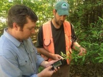
We rely on volunteer observers to help us track invasive plant infestations throughout Vermont. This project is very simple to participate in -- all you need is an iNaturalist account and a soft spot in your heart for Vermont forests.
There are many ways to be involved:
- Log observations along your favorite places to walk and hike.
- Focus on mapping the common invasive species in Vermont.
- Focus on mapping less common early detection species that aren’t established yet in Vermont.
- Host a mapping workshop for your community using outreach resources and the resources below.
Using a Smartphone/Tablet
-
Setting up iNaturalist
-
-
Download the free “iNaturalist” app
-
Make or sign into your account
-
Tap the three lines in the top left corner to find a menu; click "projects"
-
Join the "Mapping for Healthy Forests, Vermont" project on the application
-
-
Identifying invasive plants using the guide on iNaturalist
-
-
Tap on the three lines in the top left corner to access the menu
-
Click “Guides” and search for “Chittenden County, Vermont.” Select "Chittenden County, Vermont - Invasives"
-
Tap on the three lines in the top right corner.
-
Scroll to the bottom, and download guide to be available offline
-
Takes ~7Mb of storage (may change)
-
-
-
Recording observations
-
1. This quick video demonstrates how to use your smartphone to make an observation in the field
2. Every infestation should have at least one observation,
-
Some infestations of a single kind of plant will extend long distances. Please document the variability and extent of an infestation.
-
If an infestation transitions from scattered plants or clump to monoculture, record this.
-
If the infestation is continuous just makes observation every 100’ with one observation at the beginning and one at the end.
3. For each observation:
-
Take a close up photo of the identifying features of the plant; these photos will be used to confirm identification. Take multiple photos if necessary.
-
Choose project and select “Mapping for Healthy Forest, Vermont”
-
If possible, select the species name.
-
If unsure of identification, make sure to include a photo, location, and date and it will automatically be tagged for “Identification”
-
Select the appropriate “Distribution” category. Definitions below
-
Select the appropriate “Invasive Plant Condition” category. Definitions below
-
Tap “save”
4. Once you have mapped your desired area, go into the “observation" tab and click “sync” to upload all observations made onto the app. You may wish to do this back home on WIFI.
-
Not Using a Smartphone/Tablet
-
Identifying invasive plants using our field guide
-
Download and print our handy guide, designed to fit in your pocket
-
Recording Observations
-
1. Bring our datasheet with you to record what you find, then use for reference when you upload everything at a later time
2. Every infestation should have at least one observation,
-
Some infestations of a single kind of plant will extend long distances. Please document the variability and extent of an infestation.
-
If an infestation transitions from scattered plants or clump to monoculture, record this.
-
If the infestation is continuous just makes observation every 100’ with one observation at the beginning and one at the end
3. For each observation:
-
Take a close up photo of the identifying features of the plant; these photos will be used to confirm identification. Take multiple photos if necessary.
-
Note the species name, the date, the location, the distribution category (below) and the species condition category (below) and include that information with your photo when you upload later
4. When you get home, upload your photos to your computer, and navigate to : https://www.inaturalist.org/projects/mapping-for-healthy-forests-vermont on your computer (you'll need to create an iNaturalist account if you don't have one already)
-
Click the link on the ribbon that says “Add observations”
-
Fill out the information
-
Start with the first observation on your datasheet.
-
Begin typing the species name under “What did you see?” A dropdown will appear with options: select the correct one.
-
If you are unsure of the identification, check the box that says “ID Please?”
-
-
If the plant was part of a landscaped area or garden, check the box next to “Was it captive/ cultivated?”
-
Under “When did you see it?” select the date and time of the observation (date format: YYYY-MM-DD, followed by time).
-
Under “Description” add any relevant details that may not be covered by other data you will be entering
-
Under “Where were you?” there are a few options. First of all, enter the name of the place in the appropriate box. Then:
-
If you used a GPS unit to record exact location, you can click “Edit” in the Lat/Lon box and enter the latitude (Lat), longitude (Lon), and accuracy in meters (Acc). Source (Src) will fill in automatically. (Note: If your GPS unit records in UTM or degrees-minutes-seconds you can convert to decimal degrees here: http://www.rcn.montana.edu/resources/converter.aspx).
-
Otherwise, you can navigate to the area of your observation using the map. Use + and – buttons to zoom in and out, respectively, and use the mouse to drag the map around. Click the Map and Satellite buttons to choose whichever is easier for you to navigate by. Note that when you are zoomed in to a location the Lat, Lon, and Acc fill in automatically, with Acc (accuracy) depending on how closely you are zoomed in.
-
Underneath the map, set “Change geoprivacy” to “open”
-
-
Under “Add media,” click “Browse…” to navigate to the image files on your computer. Select the images you want to include with this observation. After you click “Open” in the popup window, you should notice that the correct number of files are selected next to the Browse button.
-
Under “Fields for Mapping for Healthy Forests: Vermont” you will see drop-down menus for “Distribution” and “Invasive Plant Condition.” The options here match the ones on your data sheet – choose the correct options.
-
Click “Save observation,” or, if you plan on entering more observations now, “Save and add another.” The latter will open a new observation form, and you start the process over for your next invasive plant observation!
-
-
Resources for Everybody
-
Invasive Plant Distribution Categories
-
Single Plant or Clump: One clump or a few individuals of an invasive plant with no other plants in sight. As far as you can see this is an isolated occurrence and you have not seen one in the past 50-100’ or down the road. Use this is you see 4 plants or fewer or 2 clump or fewer in a short distance.
Scattered Plants or Clumps:Multiple plants are present and from each plant you can see a few more. There is native vegetation or space available for vegetation between plants and clumps.
Scattered Dense Patches:Dense area of ten plants (or more), within patches very limited diversity, generally greater than 30’ x 30.’
Dominant Cover: In a large area greater than 75’ x 75’ the invasive plant is more common than any other plant in one of the following: Herbaceous layer (0-1’), Understory (1-5’), Midstory (6-30’), Overstory or canopy 30’+
Monoculture: In an area exceeding 75’ x 75’, there are few other species present
-
Invasive Plant Condition Categories:
-
Immature (seedling/sapling): A young plant or population that is not yet able to produce seed.
Suppressed (few or no seeds produced): This plant is unable to produce seeds in its current position due to limited light or nutrients, regardless of its maturity. If you are unsure please select the “Likely seed producer” option.
Likely Seed Producer: This plant has seeds or is mature enough to produce seeds.
-
Regional Noxious Weed Lists
-
New York Prohibited and Regulated Invasive Species; and invasive species assessments
-
Resources on management and control
-
Vermont prevention and management
Susperstar mappers
- Going Above and Beyond